Pemi Loop Guide: Water, Elevation, Direction and Timing for All 31.7 Miles
2026 access notice. The Lincoln Woods Trail — the start and finish described below — is closed June 15 through November 2026 under Forest Order R9-22-26-02, from Route 112 to the Osseo Trail junction. The ridge is untouched and the loop is still hikeable from alternate trailheads: see Pemi Loop alternate routes for 2026. Everything on this page — the numbers, the water, the climbs, the camping rules — applies either way. Last verified July 2026.
The Pemi Loop is 31.7 miles with 9,215 ft of elevation gain, and it is the benchmark hard day in the White Mountains. It rings the Pemigewasset Wilderness on the ridgeline, links ten 4,000-footers, and spends roughly nine miles above treeline across two of the finest traverses in the Northeast — Franconia Ridge and the Bonds.
This is the planning page: how long it really takes, where the climbs actually are, where the water is, what the new bear canister rule means for you, and how to decide which direction to go. For the 2026 trailhead situation, use the alternate routes guide.
How long is the Pemi Loop?
31.7 miles, 9,215 ft of gain. At AMC book time — half the distance in hours plus 30 minutes per 1,000 ft of climbing — that is about 16 to 25 hours of moving time, depending on pace.
You will see other numbers, and they are not wrong so much as differently drawn:
| Figure you'll see | What it's counting |
|---|---|
| ~30 mi | The ridge circuit with no side trips at all |
| 31.7 mi / 9,215 ft | Our mapped route — the figure used across HikerNerd |
| ~33 mi | Adds the West Bond spur (1.0 mi round trip), Galehead's Frost Trail (0.8 mi), and the Guyot shelter spur (0.4 mi) |
| 35–50 mi | "Extended" and "Super" Pemi variants that tack on Zealand, North Twin, Owl's Head, or the Hancocks |
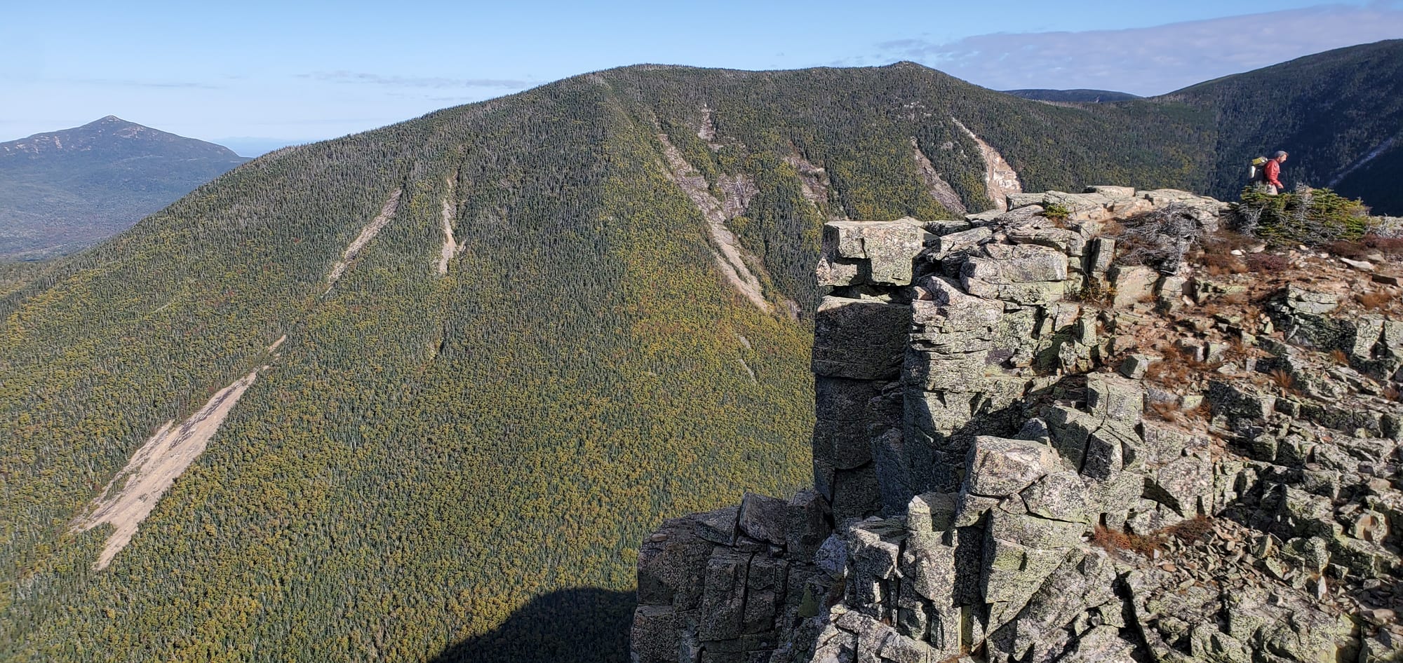
The honest summary: plan for 32 miles and 9,000-plus feet, and add a mile for every spur you decide you want. West Bond in particular is worth the detour — the view back at Bondcliff is arguably the best on the loop.
The elevation profile, climb by climb
The Pemi's difficulty is not the total gain. It is that the gain arrives in a series of discrete walls with real descents between them, so you never bank altitude. Going Franconia-first from Lincoln Woods, approximate cumulative distances (excluding spurs):
| Point | Mile | Elevation |
|---|---|---|
| Lincoln Woods trailhead | 0.0 | 1,160 ft |
| Osseo Trail junction | 1.4 | — |
| Mount Flume | 5.6 | 4,328 ft |
| Mount Liberty | 7.0 | 4,459 ft |
| Little Haystack | 8.8 | 4,760 ft |
| Mount Lincoln | 9.5 | 5,089 ft |
| Mount Lafayette (high point) | 10.5 | 5,260 ft |
| Mount Garfield | 14.2 | 4,500 ft |
| Garfield Ridge campsite | 14.4 | — |
| Galehead Hut | 16.9 | — |
| South Twin | 17.7 | 4,902 ft |
| Mount Guyot | 19.7 | 4,580 ft |
| Mount Bond | 21.0 | 4,698 ft |
| Bondcliff | 21.9 | 4,265 ft |
| Franconia Brook junction | 28.1 | — |
| Lincoln Woods trailhead | 31.0 | 1,160 ft |
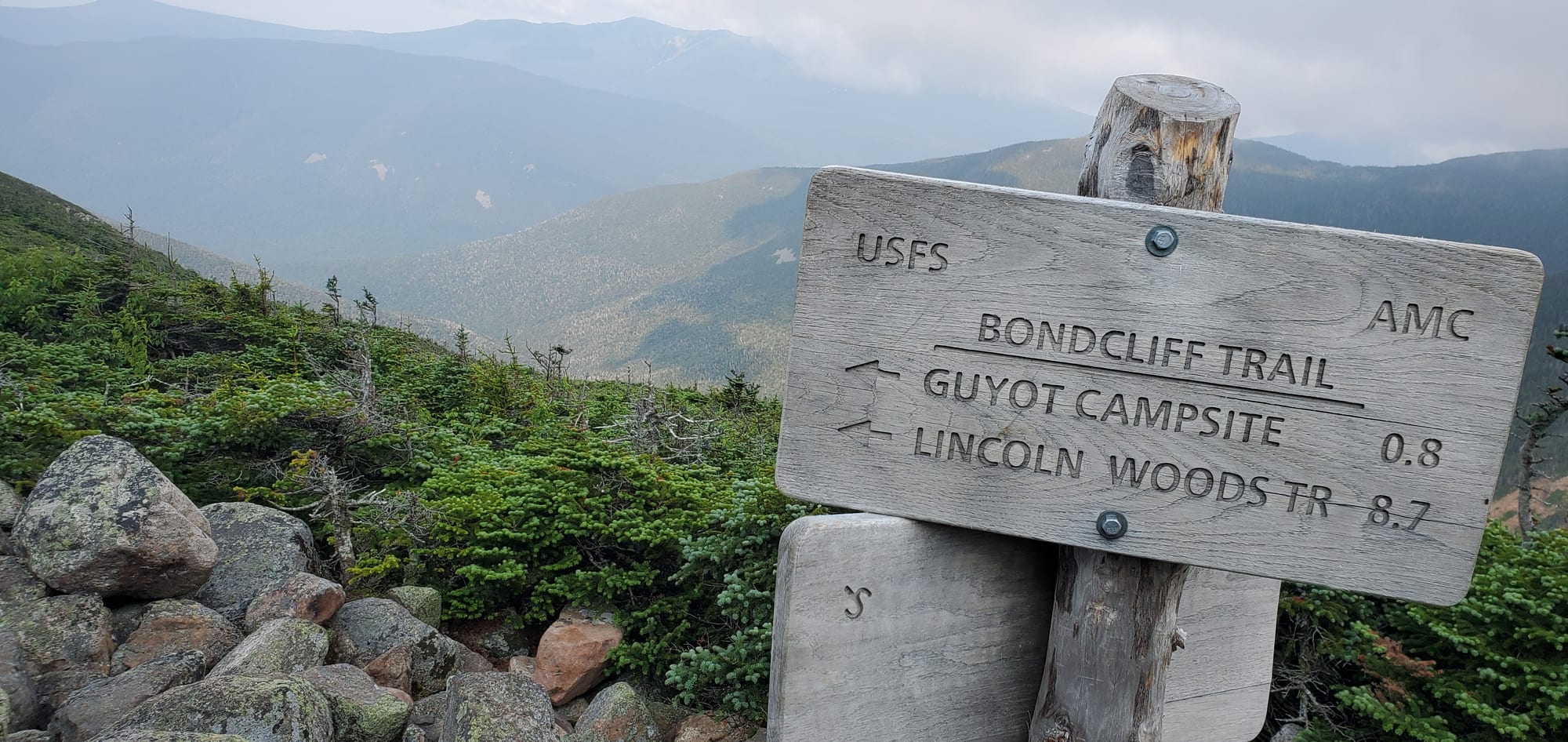
A word on why these numbers never quite agree. Signed distances, mapped distances and your GPS will all disagree on this loop, sometimes by half a mile a leg. The sign at the Twinway junction north of Guyot gives 8.7 miles back to the Lincoln Woods Trail; the current maps give 8.4 for the same stretch. Carved signs outlive trail relocations and guidebook re-measurements, and neither number is "wrong". Plan on the larger one.
Three climbs decide your day:
- Osseo Trail, mile 1.4–5.5. About 2,950 ft over 3.8 miles onto the ridge. Moderate and steady for the first two miles, then steeper with wooden staircases near the top. Going this direction you climb the ladders instead of descending them, which most people prefer.
- Galehead Hut to South Twin, mile 16.9–17.7. Roughly 1,100 ft in 0.8 miles. This is the crux of the loop: a relentless rock staircase with no switchbacks, arriving at around mile 17 when your legs are already gone. Everyone remembers this one.
- Bondcliff Trail descent, mile 21.9–28.1. Not a climb, but 6+ miles of rough, rocky, root-bound descent followed by flat railroad grade. This is where single-day attempts fall apart and where headlamps come out.
Which direction should you hike the Pemi Loop?
Default recommendation: Franconia Ridge first, going Lincoln Woods → Osseo → Flume → Liberty → Lincoln → Lafayette → Garfield → Galehead → South Twin → Bonds → out.
The reason is weather. Franconia Ridge is the longest continuously exposed stretch on the loop, and White Mountain thunderstorms build in the afternoon — July is the worst month for it. Franconia-first puts you across that ridge in the morning. It also means you climb the Osseo ladders rather than descending them, and you finish on trail that is rough but sheltered, where being caught out after dark is merely unpleasant instead of dangerous.
Going Bonds-first is the better choice for a two- or three-night backpack. The campsites land at more civilized intervals in that direction, and you cover the flat river miles while fresh instead of stumbling over railroad ties in the dark. The trade is that Franconia Ridge lands at the end of your trip, in the afternoon, on tired legs.
A note on terminology: guides label these directions "clockwise" and "counterclockwise" inconsistently — some sources call the same route by both names. Ignore the clock and go by trail names.
Water on the Pemi Loop
Yes, there is water on the Pemi Loop, but almost none of it is on the ridge itself. The reliable sources are the campsites and the hut, and there are two long stretches with nothing dependable between them.
Sources worth planning around:
- Liberty Spring tentsite — spring about 0.3 mi down the Liberty Spring Trail from the Franconia Ridge junction. Reliable.
- Garfield Ridge campsite — piped spring right at the spur junction, immediately on your right coming from Galehead. Runs solidly through the summer and is the single most useful source on the loop.
- Galehead Hut — potable water from a spigot when the hut is open and staffed. Also snacks, a roof, and a posted forecast.
- Guyot campsite — spring below the shelter, roughly 0.2 mi down the spur.
The two stretches to carry for, whichever way you go:
- Liberty Spring ↔ Garfield Ridge campsite — roughly 7 miles with nothing reliable. This is the Little Haystack–Lincoln–Lafayette traverse: dry, fully exposed, and usually the hottest part of the day. Going Franconia-first you leave Liberty Spring and get nothing until Garfield.
- Guyot ↔ Franconia Brook junction — the long Bondcliff Trail leg. The Black Brook crossings partway down are the only water on it and have been found bone dry in late summer, so assume nothing. Franconia-first this is your final descent, when you're least likely to want a detour back uphill for water.
Practical rule: top off at every campsite spring you pass, and carry three liters onto Franconia Ridge in summer. Greenleaf Hut is a possible bailout for water off Lafayette but it is a 1.1-mile descent each way — a genuine detour, not a top-up.
Bear canisters are now required — this is new
As of May 1, 2026, an IGBC-certified bear canister is mandatory for overnight stays inside the Pemigewasset Wilderness. This is Forest Order R9-22-26-03, signed 30 March 2026 and in effect until May 2031. Most Pemi guides online predate it and still tell you to hang a bag. That advice is now illegal.
The exact requirement: all food, food containers, scented items (soap, lip balm, toothpaste) and refuse must be stored in a cylindrical, hard-sided, non-pliable IGBC-certified bear resistant canister, except while being prepared, eaten, or under direct visual observation. Hanging, Ursacks and other soft systems no longer qualify — the Forest Service's stated reasoning is that alternative methods proved ineffective as human-bear conflicts rose between 2021 and 2025.
What this means on the loop:
- Guyot campsite is inside the Wilderness — bring a canister. Its bear boxes do not exempt you.
- Garfield Ridge and Liberty Spring sit outside the Wilderness boundary, so standard White Mountain food-storage practice applies there.
- The only named exception in the order is the supplied food storage box at the Thirteen Falls tentsite.
Violation is a Class B misdemeanor carrying a fine of up to $5,000 for individuals. If you don't own a canister, the WMNF runs a free loan program at the Lincoln Woods Trailhead Cabin, the Pemigewasset Ranger Station in Campton, and the Saco and Androscoggin ranger stations. Boundaries matter here and they are not obvious on the ground — if you are unsure whether your intended site is inside the Wilderness, call the Pemigewasset Ranger District at 603-536-6100 and carry the canister anyway.
Where to camp
All backcountry sites on the loop are first-come, first-served — none can be reserved — and AMC sites charge $15 per person per night with a caretaker in season.
- Liberty Spring tentsite — 10 tent platforms, 0.3 mi below the ridge. The natural first night going Franconia-first.
- Garfield Ridge campsite — 12-person lean-to plus 7 tent platforms, excellent water.
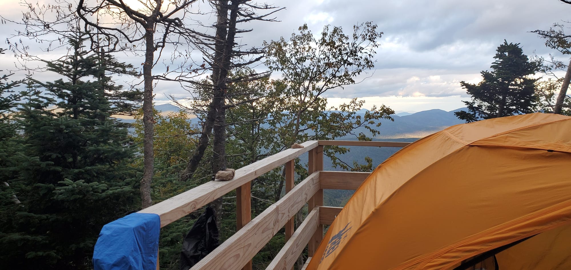
- Guyot campsite — 12-person lean-to plus 6 tent platforms at 4,360 ft, 0.6 mi south of the Twinway junction plus a 0.2 mi spur down. The best-positioned site on the loop for the Bonds, and a short walk from the West Bond spur for sunrise. Canister required.
- Thirteen Falls tentsite — 9 tent pads, well off the ridge, with the only exempt food boxes.
- Franconia Brook tentsite — 20 sites near the valley floor, useful for a pre-dawn start.
- Galehead and Greenleaf huts — full service, reservations required, and they book out early for summer weekends.
On summer weekends and holidays the platforms fill. Plan a midweek trip, start early, or carry a plan for dispersed camping that complies with Wilderness regulations — 200 ft from trails and water, and no camping above treeline.
Can you hike the Pemi Loop in one day?
Yes, and a lot of people do — but it is a genuinely serious day, not a long hike.
- Book time works out to 16-25 hours. Fit, experienced hikers typically finish in 12–16 hours; the commonly cited range across all comers is 10–20.
- The FKT is 5:27:20, set by Jordan Fields in August 2020. That is a trail-running benchmark and tells you nothing about your day.
- Realistically: start before dawn, carry a headlamp regardless of how fast you think you are, and know that most single-day parties finish the Bondcliff descent in the dark.
Single-day attempts fail for predictable reasons — running out of water on Franconia Ridge, underestimating the Galehead-to-South Twin wall, and misjudging how slow the final rocky miles are on wrecked legs. If the forecast is marginal above treeline, this is a hike to postpone rather than start.
Bailout options
The Pemi's saving grace is that you can escape from most of it, right up until you commit to the Bonds:
- Off Franconia Ridge: Falling Waters or Old Bridle Path down to Lafayette Place, or the Liberty Spring Trail to the Whitehouse Trail — all short, all to Route 93.
- Off Garfield: the Garfield Trail down to Gale River Road.
- Off Galehead: the Gale River Trail, also to Gale River Road.
- Off South Twin / the Bonds: the North Twin Spur to the North Twin Trail, or the Twinway east to Zealand.
Past Guyot heading for Bondcliff there is no short way out — you finish the Bonds and the long valley walk. Make your go/no-go decision at South Twin.
Hikes similar to the Pemi Loop
If the Pemi is more than you want, or the trailhead situation rules it out:
- Z-Bonds traverse — 18.9 miles from Zealand over Guyot out to Bondcliff. Reaches the remote Bonds, no fords, shuttle-served, and skips Franconia Ridge entirely. The closest thing to "half a Pemi".
- Bonds out and back — 22.1 miles. The Bonds without committing to the full ring.
- Franconia Ridge loop — 8.9 miles over Little Haystack, Lincoln and Lafayette. The most famous stretch of the Pemi as a day hike.
- Franconia Ridge with Flume — 15.4 miles, adding Liberty and Flume to the ridge. A serious day that is still half the Pemi's length.
- Twins and Galehead — 11.5 miles covering the northern arc without the Franconia half.
Weather: the thing that actually decides your trip
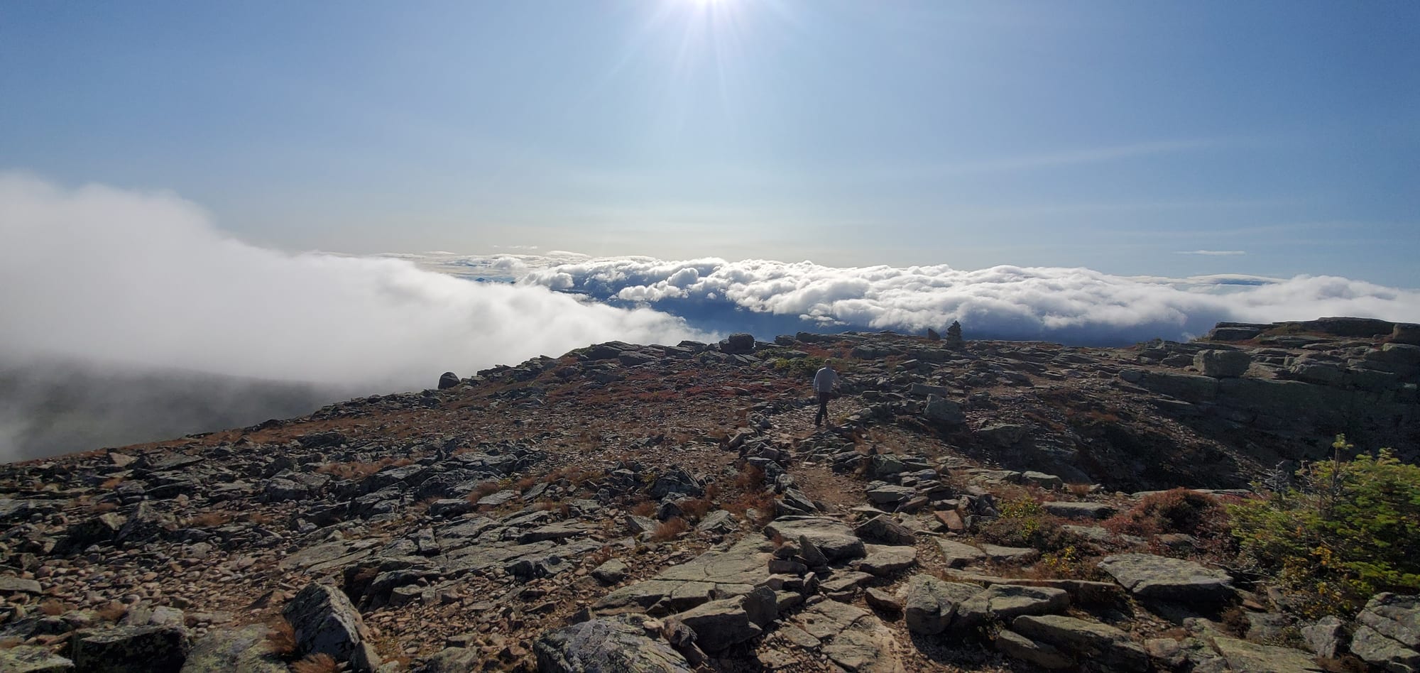
Nine miles above treeline means the forecast is not a detail. Summit conditions on Franconia Ridge and the Bonds routinely run 20–30°F colder than the trailhead with winds that make walking difficult above 40 mph, and the ridge offers no shelter to retreat into.
Check the summit-level forecast, not the valley forecast for Lincoln — Mount Lafayette weather and Mount Bond weather give you the elevation-band picture along the two exposed traverses, and the conditions dashboard covers every peak on the loop. July carries the highest thunderstorm risk of the year. If the ridge is forecast to be in the clouds with wind, the Pemi will still be there next month.
Sources and last verified
Verified July 2026 against:
- USFS — Pemigewasset Wilderness Food Storage Requirement and Forest Order R9-22-26-03
- USFS — Lincoln Woods Trail Closure and the White Mountain NF alerts page
- AMC — Backcountry Campsites for fees and first-come policy
- SectionHiker — Backpacking a Pemi Loop for trail-sequence distances
- Fastest Known Time — Pemigewasset Loop
Closure dates, fees and food-storage rules change. Confirm current status on the Forest Service alerts page before your trip.